This hike is supposed to be the best day hike in New Zealand. And, no less important for a fan, the site of Mordor and the infamous Mt. Doom...
From our hostel in Taupo, it is about an 1,5 hour drive to the start of the track. We quickly make and eat breakfast, pack our bag with snacks, lunch, water and some extra clothing and go outside. Just as the birds wake up.
From our hostel in Taupo, it is about an 1,5 hour drive to the start of the track. We quickly make and eat breakfast, pack our bag with snacks, lunch, water and some extra clothing and go outside. Just as the birds wake up.
 |
| Amazing ice formations |
During our drive we watch the sun rise, the first rays of light give the snow capped peaks in pink hues over lake Taupo. At 7:20 we get a briefing and then we start walking. It's still freezing and we're glad we've got many layers on.
The hike is divided into sections, to help you time your progress, the time for the main track is usually 6-8 hours.
 |
| Through the Mangatepopo Valley |
The first section is from Mangatepopo Valley to Soda Springs, and quite flat. After about 15 minutes we start peeling, the wind proof top layer isn't necessary as we're warming up. It's still freezing, but there's no wind, and the sun that peeks over Mt Ngauruhoe (Mt Doom's real name), is strong. We apply sunscreen and walk passed low vegetation and icy pools. A boardwalk leads us through the frozen marshes. Every few minutes one or several people overtake us, but we are too busy savouring the views to mind. Before we know it, about an hour later, we are already at Soda Springs. Also the site of the last (busy!) toilet.
 |
| View from the Devil's Staircase |
After Soda Spring we start the real ascent. The climb to South Crater is a challenging one. Mostly stairs, one after another. In between we seize many opportunities to admire the views (code for catching our breath...) But everyone here is panting, it's not just us! And the views are just stunning. After about an hour we are past the Devils Staircase, and decide that it's time for morning tea. The water in our thermos is still warm, which is good, since it's quite cold once you stop moving! We look back at the route we've walked and are amazed at how far we've come, and that that boardwalk definitely wasn't level either. While we take our break right at the foot of Mt Doom, we see the fresh snow on its slopes from the day before. And from its top continuously appear white plumes, Mt Doom is smoking...
 |
| Looking back at Mt Doom from the flat South Crater |
We then walk on over a small the ridge, and are at South Crater. This is actually not a crater, but an glacially formed basin, filled with volcanic debris. Whatever it is, it's an amazing section. Though bit muddy, it's really impressive to walke across an empty space, bordered by volcanic ridges.
At the other end is the last climb to the highest point of today. As we approach it we see people snaking up the track to the top. Slowly but steadily we climb up the first half of it. It's icy, slippery and rocky, so we have to focus on where to place our feet. Halfway up many people take a break, and we do too. We drink another cup of tea (only luke warm by now) and eat a nut bar. And admire the views, completely different from the last stop, and even more stunning.
 |
| Looking back from the top of the Red Crater |
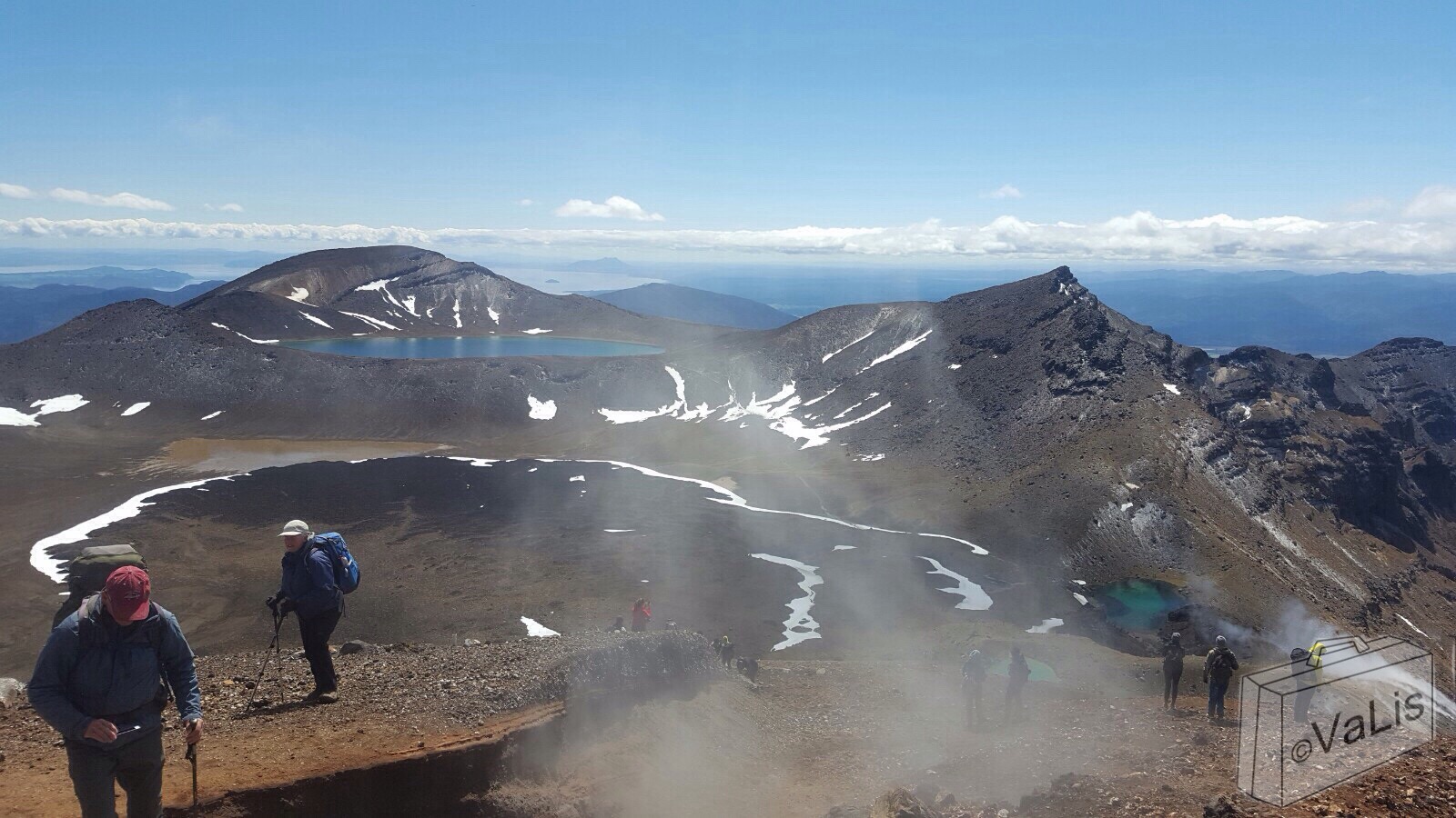
We move on to the top of the Red Crater. This part is really tricky. The track is in the shadow of the ridge, thus not thawed by the sun and on top of that, very narrow. On the right hand side is a rock wall, and on the left side a steep slope goes a hundred meters down. This is the first time (and it turns out, the only time) a steel chain is attached to the rock as a handhold. As we make it to the ridge, the smell of sulphur increases, and steam rises from the ground all around. On the left side we see Blue Lake in the distance, on the right we see the most bizarre and amazing rock formations.
 |
| Looking forward from the top of the Red Crater |
Another few meters to the top of the ridge. And what a spectacular view: the brilliant Emerald Lakes lay beneath us, Blue Lake further ahead and in between the Central Crater with patches of snow in between the whirls of steam. After a while we descend: a tricky business! The ash and pumice form a very loose surface: imagine a high sand dune. But with a ravine on both sides.
Hopscotching we make our way down, and find a nice rock to have lunch on. Bacon and egg sandwiches in sulphur steam, that's a new experience. As we eat our sandwiches, they get harder to bite... That actually freeze while we eat! No wonder I feel like I have to eat with gloves on!
We don't sit for long, fearing we might get too cold.
 |
| Crossing the Central Crater |
We make our way across the Central Crater towards Blue Lake walking occasionally through snow. Another quick ascent and were at the shore of Blue Lake. We start our final descent. Having said that, we're only halfway! We walk another hour over a narrow track towards the hut (and toilets) on the other side. Though it offers beautiful views, of both the geothermal area and Lake Taupo ahead, this part is simply not as spectacular and surprising as the previous sections. We walk through patches of snow, see several fumaroles, and the first flowering plants. Once we are on the others side of the craters, the track snakes down to Ketetahi hut. Ever winding we see the hut from above, but it takes a long time before we are actually there. In reality probably half an hour or so. Next to the path are the Ketetahi Springs. We can see and smell them, but they are not accessible.
 |
| On our way to Ketetahi hut |
The final section is from the Ketetahi hut to the car park, where our shuttle awaits. This is the part where we are struggling. It's all downhill, and with many stairs on the way. Did I tell you 'bout my crappy knees before? I seriously dislike going downhill. And this time, I was not alone in my struggling. Maybe we are getting to old for this? But nothing to be done about it, we have to go on. Only 6 more kilometres.
It's getting a lot warmer now, and I remove another few layers of clothing. Going downhill so steeply does cause a interestingly quick change in vegetation. We start at low Alpine grasses, then walk through larger bushes, and after another turn we are suddenly in a forest!
We've crossed a little stream higher up the hill, but by the sounds of it, we found a bigger one now. A sign tells us this us a Lahar hazard zone : 'Move quickly through', 'No stopping' and 'If you hear noise from upstream, do not enter'.
We decide it's safe enough, and go on. We are at the carpark, and the shuttle, at half past three. Tired, but very content.
 |
| View from the Red Crater forward |
And if you're wondering how the day after is? I'm sore all over! And we're staying in a first floor hostel, without a lift...


